
Get started with Geoscape
Geoscape is the digital Australia – a comprehensive representation of our built environment. It describes the addresses, land, buildings and transport networks across Australia’s 7.6 million km2. We continuously source, process and deliver data to various endpoints, including APIs and a self-service portal.
Data Catalogue
The data catalogue provides crucial information about our data products, solutions and the formats they are currently available in.
For more information please contact us.
Geoscape Products
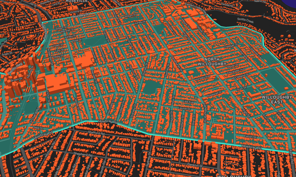
Buildings
A digital representation of every building in Australia – currently 16 million+. Deep dive into the data with attributes such as building outlines and heights, addresses and planning zones.
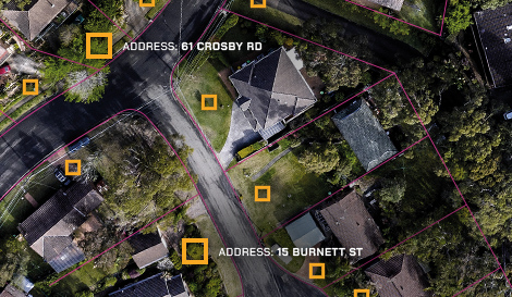
Addresses
Every physical address in Australia – more than 15.2 million addresses – with coordinates of latitude and longitude. Address data is continually updated and consistently formatted.
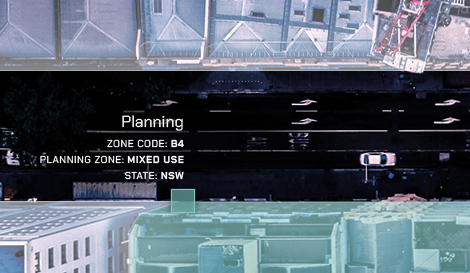
Land Parcels
Geoscape Land Parcels includes Cadastre, Property, Planning and Planning Insights datasets for a complete picture of land information in Australia. Over 17 million land parcels are captured for comprehensive cover.
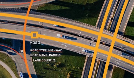
Transport
Geoscape Transport incorporates Roads, Rail and Airports datasets. Road definitions and the representation of railways, stations and landing strips are consistent across Australia. Combined, these datasets can enhance analysis of transport networks.
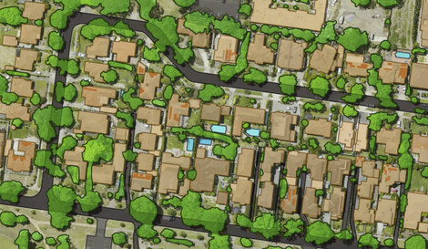
Surface Features
Geoscape Surface Features describe what’s on the surface of the earth at a location. It includes National Surface Cover, Urban Surface Cover, Urban Trees, Greenspace and Hydrology datasets.

G-NAF
The G-NAF dataset contains all physical addresses in Australia. It’s the trusted source of geocoded address data for Australia. Over 38 million contributed addresses are distilled into more than 15.2 million G-NAF addresses. G-NAF is built from addresses supplied by 10 contributors, including the land agencies in each state and territory of Australia.

G-NAF Core
G-NAF Core makes accessing geocoded addresses easier. It provides the core richness and power of G-NAF in a comprehensive, but easy-to-use format.
G-NAF Core reduces the complexity of G-NAF by delivering the data in a simplified table model. G-NAF’s approximately 50 tables are cut to two: one for current addresses and one for retired addresses. This reduces the need to select fields and build data relationships to access G-NAF’s essential address data, making it easier to use with less technical effort.
Postcode Boundaries
The Postcode Boundaries dataset is the definitive set of Australian postcodes and their geographic boundaries. It enables a wide range of spatial aggregation and analysis activities, including the visualisation of postcode areas.
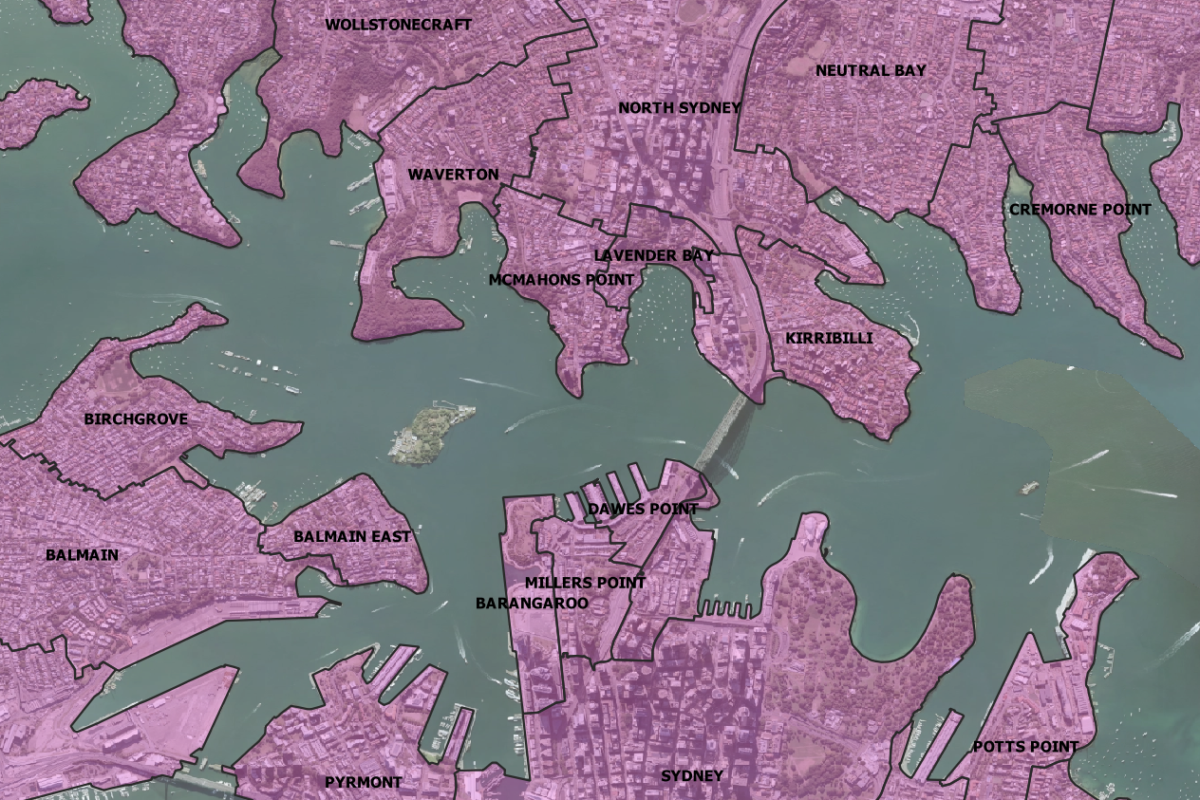
Administrative Boundaries
Geoscape Administrative Boundaries is Australia’s most comprehensive national collection of boundaries, including government, statistical and electoral boundaries. Built and maintained by Geoscape Australia using authoritative government data, Administrative Boundaries comprises of 7 data products.
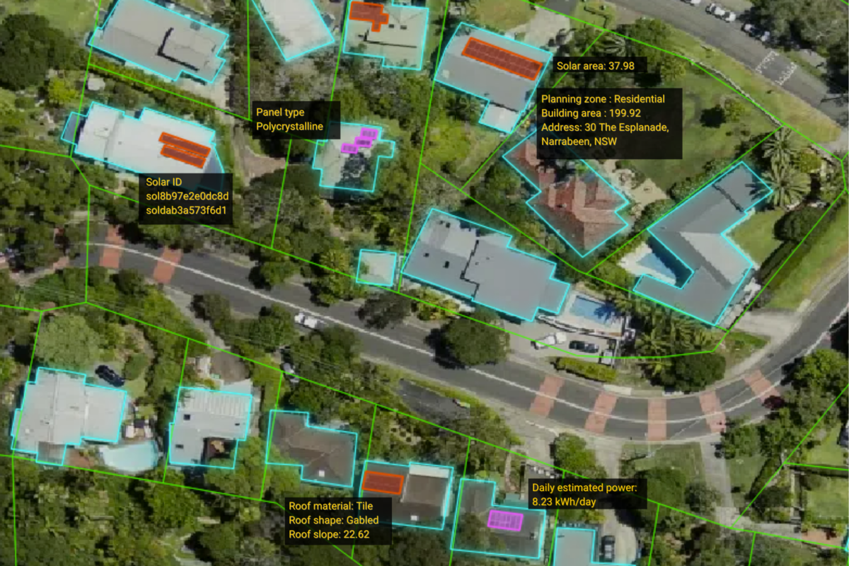
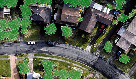
Solar
Geoscape Solar gives you access to photovoltaic solar panels around Australia. The dataset is captured via high-resolution aerial images, using artificial intelligence (AI) technology. The AI process identifies the types of panels installed – Monocrystalline, Polycrystalline or Thin-film. Our data also provides an estimation of the power generation potential of buildings’ solar panels!